Let homeowners draw the fence on their own yard, from space
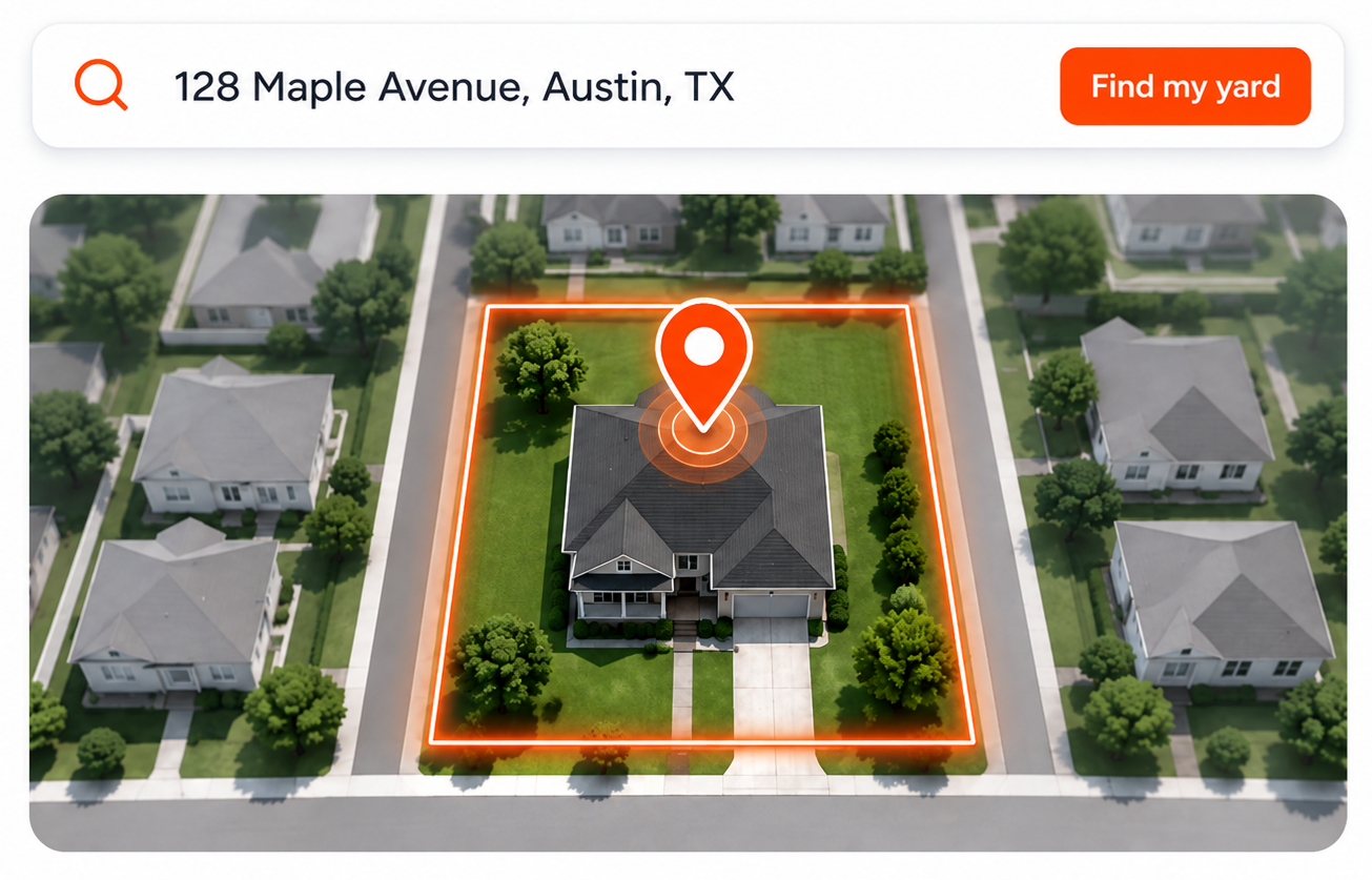
The homeowner types their address, sees their property from above, and clicks along the line where the fence will go. Footage appears as they draw, gates snap onto the line, and the whole drawing lands on your lead as a picture. You know the size and shape of the job before anyone has picked up a tape.
- Real-world footage as they draw
- Gates snap to the line
- Works on a phone
How it works
Four taps from address to footage
This is the first thing the homeowner does on your website. It has to be obvious, and it is: everyone has traced a line on a map before.
- 1
Find the property
The homeowner starts typing their address and picks it from the suggestions. The map centres on their lot in satellite view with street labels, so they recognise the roof, the driveway and the neighbour’s shed straight away.
- 2
Trace the fence line
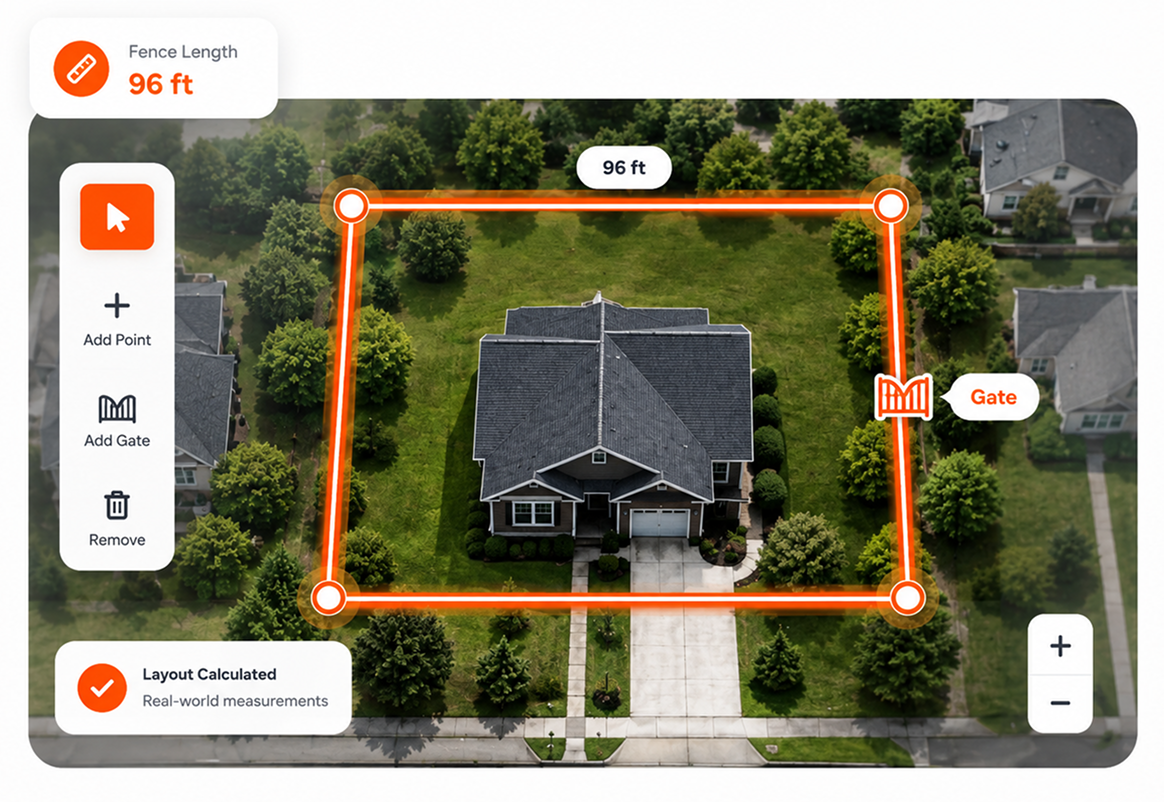
They click, or tap on a phone, at each corner where the fence turns. A line follows them, and each run shows its length in feet as they go. When the run is finished they press "Complete Fence" and can start another for the other side of the yard.
- 3
Drop the gates
A single walk gate or a double drive gate is placed with a tap. Gates snap to the nearest fence line, so a gate cannot end up floating in the lawn, and they can be dragged along the line to the right spot.
- 4
Old fence coming out?
If you charge for teardown, the homeowner is asked whether there is an existing fence to remove and how much of it. That footage is priced separately so the range they see reflects the whole job.
What the map engine does
The details that make a homeowner finish the drawing
A drawing tool that frustrates people produces abandoned estimates. These are the things that stop that happening.
Footage on every run, live
Each segment carries a label with its length in feet, and each run shows its total. The homeowner watches the number change as they draw, which is what makes them careful about where the corners go.
Several runs, one job
A back yard with a side return and a front picket run is three separate fences at three different heights. The homeowner draws each one and picks materials per run. Footage is totalled across all of them.
Gates that stay on the line
Gate markers snap to the closest point on any fence run when placed and when dragged. Single and double gates are counted separately because you price them separately.
Undo, twenty steps deep
A wrong click is not a restart. Undo (or Ctrl+Z) walks back through the last twenty drawing actions, so a homeowner who overshoots a corner simply steps back and tries again.
A snapshot of what they drew
When they finish drawing, the map with their fence lines and gates is captured as an image and attached to the lead. You see exactly what they meant before you call.
Outside your area? They are told
Draw the area you cover in your settings. If the address falls outside it, the homeowner sees a note that the property is outside your standard service area. They can still finish, and the lead arrives flagged.
Built for thumbs
On a phone the map fills the screen and the drawing controls live in a sheet the homeowner pulls up from the bottom. Corners are placed with a tap; the map pans and zooms with the usual gestures.
Real-world distance, not pixels
Lengths are computed from the geographic coordinates of each corner, so the footage is the same whether the homeowner is zoomed in tight or looking at the whole block.
Why satellite
Three ways to learn the size of a fence job
A satellite drawing is not as exact as your wheel. It is a great deal better than a number the homeowner made up on the phone, and it costs you nothing to get.
| What you learn | Homeowner’s guess on the phone | Your site visit | Satellite drawing on your website |
|---|---|---|---|
| Happens before you commit an afternoon | Yes. | No. | Yes. |
| Footage you can price from | No."About 200 feet?" | Yes.Exact | Partly.Close enough for a budget range |
| Shows where the gates go | No. | Yes. | Yes. |
| Tells you the material and height they want | Partly. | Yes. | Yes. |
| Leaves a visual record you can look at later | No. | Partly.If you took photos | Yes. |
| Costs you fuel and payroll | No. | Yes. | No. |
| Works at 10pm on a Sunday | No. | No. | Yes. |
Being straight with you
What a satellite drawing is not
It is a way to know whether a job is worth the drive. It is not a survey and it is not a takeoff.
It does not find the property line for you
The homeowner draws where they want the fence. There is no parcel-boundary overlay, and satellite imagery cannot see a survey pin. The drawing is their intent, not a legal boundary, and the site visit is where you confirm it.
Imagery is as old as the satellite pass
Most residential areas are refreshed regularly, but a new build or a recently cleared lot may look different from above. The homeowner usually knows their own yard and draws around it anyway.
A budget range, not a takeoff
Footage and gate count are enough to produce a range from your catalog. Post spacing, rail counts and concrete are not calculated here; that is what your estimating or takeoff tool is for once the job is real.
FAQ
Questions about drawing fences on satellite imagery
How accurate is fence footage measured from satellite imagery?
Accurate enough to price a budget range, which is what it is used for. A homeowner tracing their own yard usually lands within a few percent of the real footage, and your low and high per-foot figures absorb the rest. You still measure on site before the real quote; the point is that you only make that trip when the homeowner has already accepted a number close to yours.
What imagery does the fence drawing tool use?
Satellite imagery with street labels, the same hybrid view homeowners know from their phone maps, so they orient themselves immediately. Address search covers the United States.
Can the homeowner draw more than one fence?
Yes. Each run is drawn and completed separately, and each can have its own height, material, style and colour. A 6-foot privacy fence around the back and a 4-foot picket run at the front are two runs in one estimate, totalled together.
Can they place gates?
Yes. Single walk gates and double drive gates are placed with a tap and snap to the nearest fence line. They are counted separately and priced from the flat rates in your catalog.
Does it work on a phone?
Yes, and that is where most homeowners use it. The map fills the screen, the controls sit in a sheet pulled up from the bottom, and corners are placed by tapping. The same estimator works on tablets and desktops.
What if they draw it wrong?
They can undo up to twenty steps, or delete a run and start it again. If they submit something odd, you see the drawing on the lead before you call and can ask about it. A rough drawing still tells you the property, the rough size of the job and the materials they want.
Does it detect the property line automatically?
No. The homeowner draws where they want the fence. Parcel data is not overlaid, and no satellite view can show a survey marker. The drawing is a statement of intent that you confirm on site.
Do I see what the homeowner drew?
Yes. An image of the map with their fence lines and gates is captured and attached to the lead, alongside the total footage, the footage per run, the gate count and any teardown footage.
Is there a fence drawing tool for contractors to use themselves?
You can open your own estimator and draw on any address, which is a quick way to sanity-check a phone enquiry before you drive. It is designed for homeowners on your website, though, and it produces budget ranges rather than a material takeoff.
Last updated:
The drawing feeds the pricing catalog to produce the range, and the snapshot travels with the lead.
Get started
See a fence drawn on your own street
Open the demo estimator, type any US address, and trace a fence. That is what your customers will do on your website.
No credit card required.